
| Llantwit Fardre | |
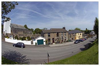
Ordnance Survey maps published before the 1950s show Llantwit Fardre village to be located around St Illtud Parish Church. Today however, the area surrounding the church is known as Upper Church Village whilst Llantwit Fardre is located just over a mile southwards. St Illtud Parish Church is on a site that has been used for worship since the fifth century although the present building only dates from the sixteenth century. The tower dates from 1636; the register from 1632, whilst the bell was cast during the nineteenth century. It was restored and rededicated in 1974. Right: Upper Church Village showing the church |
 |
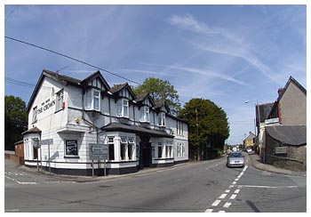 |
The 1875 Ordnance Survey map shows Llantwit Fardre to be a small village consisting of a parish church surrounded by a public house and a few cottages. The censuses preceding the map publication show the village's development to be very gradual. Indeed, it appears that between 1841 and 1861 the number of households remained constant whilst the population fluctuated. The census of 1841 shows a total population of 34 in 9 households, including a butcher, carpenter, mason, schoolmistress, sexton and two publicans. Ten years later we see that 14 miners inhabit the village. Left: The Crown - main road Llantwit Fadre |